
Red and amber weather warnings issued for Warwickshire as the heat ramps up this week
Red and amber weather warnings have been issued for Warwickshire as the heat ramps up this week.
Large parts of the UK ware due to get scorching temperatures this week as a heat wave rolls in.
The Met Office has issued an amber weather warning for ‘extreme heat’ from today to Thursday, which includes Warwickshire.
But a red ‘extreme heat warning’ has been issued for both Wednesday and Thursday, with the Met Office predicting that “June’s all-time daily record temperature forecast will be broken”.
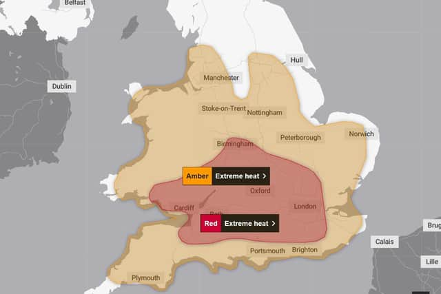

The Met Office predicts Monday could see temperatures hit around 30°C in Warwickshire but the heat will build further into Tuesday, with highs of 36°C forecast.
Wednesday and Thursday are when temperatures are expected to climb to at least 38°C, with the Met Office currently forecasting it could hit as high as 40°C in places.
By Friday, the heat is due to decrease to around 27/28 °C.
Currently, the red warnings are in place from 9am on Wednesday to 9pm on Thursday.
Met Office deputy chief forecaster Mark Sidaway, said: “Red warnings are reserved for the most severe events and we’re expecting severe and significant impacts from this heatwave, with health impacts likely for many, even beyond those who are normally more vulnerable to the heat.
“The last time the UK recorded temperatures this high was in July 2022, but on this occasion the heat is expected to be accompanied by high humidity.
“As well as very high daytime temperatures, there will be consecutive nights where temperatures do not drop below 20°C, which is called a Tropical Night.
“This will make it very hard for people to recover from the daytime heat, exacerbating the heat stress impacts.”