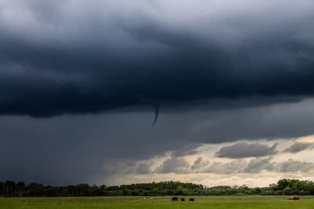
Funnel Clouds: Very rare weather phenomenon explained as people report recent sightings
and live on Freeview channel 276
The poor weather this year has thrown up a rare weather phenomenon in the UK known as funnel clouds. This cone shaped cloud rarely occurs but examples have been spotted this year. So, what is a funnel cloud, and have you seen one?
According to the Met Office “A funnel cloud is a cone-shaped cloud which extends from the base of a cloud towards the ground without actually reaching the surface.
Advertisement
Hide AdAdvertisement
Hide Ad“In the UK they often look like thin dangling bits of rope, hanging from the cloud above. But in hotspots such as tornado alley in the USA, funnel clouds can sometimes be thicker and much more intense.”
Funnel clouds are formed when a rotating column of wind draws in water droplets, which makes an intense region of low pressure visible. They are formed in the same way as a tornado building around this localised area of intensely low pressure.
They are usually a strong indicator that bad weather including heavy rain, hail, thunder and lightning are all on the way. If a funnel cloud touches the ground and produces a tornado, strong winds can be expected in the immediate vicinity, potentially causing severe damage.


Officially, a funnel cloud does not reach the earth’s surface - at the point it does reach land it becomes a tornado or, if over a body of water, a waterspout. On average, the UK experiences between 30-35 tornadoes per year, but it is very rare any cause significant damage.
